...second Autumn
by Joshua Heston
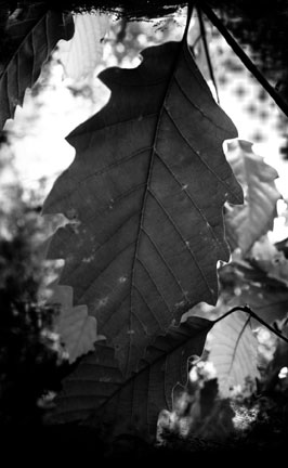
Two weeks ago, you would have thought the Ozarks in autumn had peaked. Luminous maples, crimson sumac. One good gust of wind — it seemed — would bring it all down. And last week, a good gust of wind did just that, leaving behind the bare arms of sweet gum, walnut and maple.
What was a bit surprising was what remained: Black oak, white oak, scarlet oak, ash tree and sycamore slowly but surely blossoming into a second and equally stunning autumn — an Indian summer of sorts — a brief reprieve from the oncoming winter. Crows and blue jays call. Hawks circle. The black walnuts are plentiful, as were the persimmon. The squirrels are busy. It’s been a different sort of year.
Last winter was warm and green — the kind in which tepid folk glory. Little snow, little ice, a bit of fog, a lot of sun. Made for easy living. And yet, I believe it was Vance Randolph who recorded the Ozark observation “a green Christmas makes for a green cemetery.” Hillfolk connected a warm winter with the proliferation of death the following summer. And while I can’t make a case for that one way or another, I can say this:
In our oft-tepid and technology-surrounded lives, it is so easy to become disconnected from the realities of this world. Cause and effect. Responsibility. Accountability. There is nothing free in this life, however long or short it may be. All things have a price.
Even something as beautiful as a second autumn in the hills. Winter is coming.
—from November 11, 2012 State of the Ozarks Weekly Issue 261
These Old Hills & Hollers
“The Ozark terrain contains unique land forms, shaped during the land's distant past. The Ozarks, which contain some of the oldest exposed rock in North America, have undergone a series of uplifts, erosional cycles, climatic changes, and geologic events such as volcanoes and earthquakes.
The land also contains a variety of different rocks from hard, weather-resistant granite to limestone and dolomite that can be dissolved by water.
Because of this geologic variety, the Ozarks have special landscape features such as sinkholes, shut-ins, weather-shaped large rocks and entrenched meandering steams.”
— excerpted from the Missouri State Museum, Jefferson City, Missouri.
bald knob:
a treeless, but usually grass-covered knob. See knob. Glossary, page 169
cove:
in Ozark parlance, a narrow, steep-walled valley with a spring or waterfall at the head, which usually falls swiftly to a larger valley at the cove mouth. On Ozark lakes, locals also use the word “cove” as it is widely known, to mean a small, enclosed arm of the lake. Glossary, page 169
holler:
Ozark spelling /pronounciation of “hollow.” The word holler, of course, means “to yell”; the two meanings can be distinguished by context. See hollow. Glossary, page 171.
hollow:
a narrow valley or deep depression in the terrain. There are thousands of hollows in the Ozarks, among the hills and knobs. See knob. Glossary, page 171
knob:
(sometimes spelled nob) a narrow, high hill with a capstone top, surmounted by a dirt dome. Knobs may be tree-covered or bald (without trees but grass-covered. Glossary, page 171
Excerpts — Young, Richard & Judy Dockrey, Ozark Ghost Stories, August House Publishers Inc., 1995.
Plate 1. Bear Mountain is intriguing as the sun sets. Blue hills beyond beckon and autumn colors shine through dark silhouettes. Drury-Mincy Conservation Area, Taney County, Missouri. October 28, 2011.

Plate 2. Sinewy hickory trunks snake black against brilliant late-fall color. Drury-Mincy Conservation Area, Taney County, Missouri. October 28, 2011.

Plate 3. A sassafras seedling reaches for the sun. Drury-Mincy Conservation Area, Taney County, Missouri. October 28, 2011.
...the Ozark Rhineland
by Joshua Heston
That’s what they call it, the extreme upper northern Ozarks between St. Louis and Jefferson City. That stretch, on both sides of the Missouri River, was settled back in the 1840s by German immigrants. And, in fact, it is so far north of what folks think of as ”Ozarks,” the Rhineland usually gets classified as ”Midwest.”
I recently got the chance to drive down Highway 19 from Hannibal all the way to Cuba. After that, I got on I-44 to Springfield and there wasn’t as much to write about then (though I did make mighty good time).
But that comparatively short stretch of my journey? It was downright fascinating. You see, I’m used to getting into (or out of) the Ozarks by Highway 65, or through Jeff City (Highway 54) or just through St. Louis. On either route, there's a common theme:The Ozarks kinda sneak up on a guy.
From the north, the Ozarks are typically an eroded mountain plateau into which you slowly fall... not a dramatic mountain range you visibly approach.
The Rockies we ain’t.
I really think the lay of the land is the biggest reason for so much confusion as to where the Ozarks begin. And why many travelers can pass through a hundred miles of the Ozark Mountains without realizing it.
But on old Highway 19, between Laddonia and Cuba, it’s a different story.
South of Laddonia (the ethanol capital of the universe or something like that) you drive through open fields and small towns that could easily be mistaken for central Illinois or southern Iowa. Corn. Soybeans. Big churches. Small main streets. The roads trace township lines. Grain elevators punctuate the sky.
Then you cross I-70 and fall into the Ozarks. It’s the darndest thing I ever saw. One minute, cornfields. You cross the interstate and it’s all cedar trees, rocks, hardwood timber... And then the hills begin.
As you get nearer to Hermann, the landscape just gets prettier and more dramatic.
Massively distinct ridges, deep, wide valleys, winding rivers. It is, undeniably, the Ozarks. And this is an Ozark region often overlooked.
So if you get a chance, drive down Highway 19. I think the Ozark Rhineland will get into your heart, maybe before you even realize it.


